
Cooperative Formed to Make Rural Life Better
Three Rivers Electric Cooperative was formed February 22, 1939 when the articles of incorporation were signed by 12 businessmen who wanted everyone in the central Missouri area to have electricity. The men visited with friends and neighbors to explain what was needed to set up a rural electric cooperative. It was often a hard sell. Some thought electricity was a luxury, something they wouldn’t use and couldn’t afford. Some people accused the men of trying to “scam” them with “highfaluting” ideas that would never come to pass. With others it was a matter of economics – they didn’t have the $5.00 membership fee.
The Cooperative was named for the three rivers that cross its service territory: Gasconade, Maries and Osage. This is also how the three districts are divided.
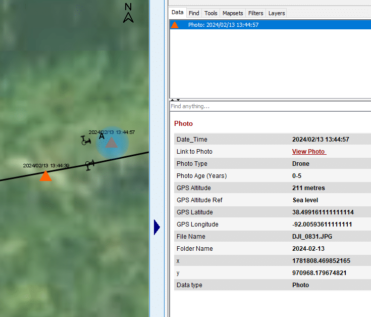
Three Rivers has been working with Partner Software since 2009. The following user experience submission comes from Engineering Coordinator, Aaron Winters about his recent experience using Partner Software with drone inspections.
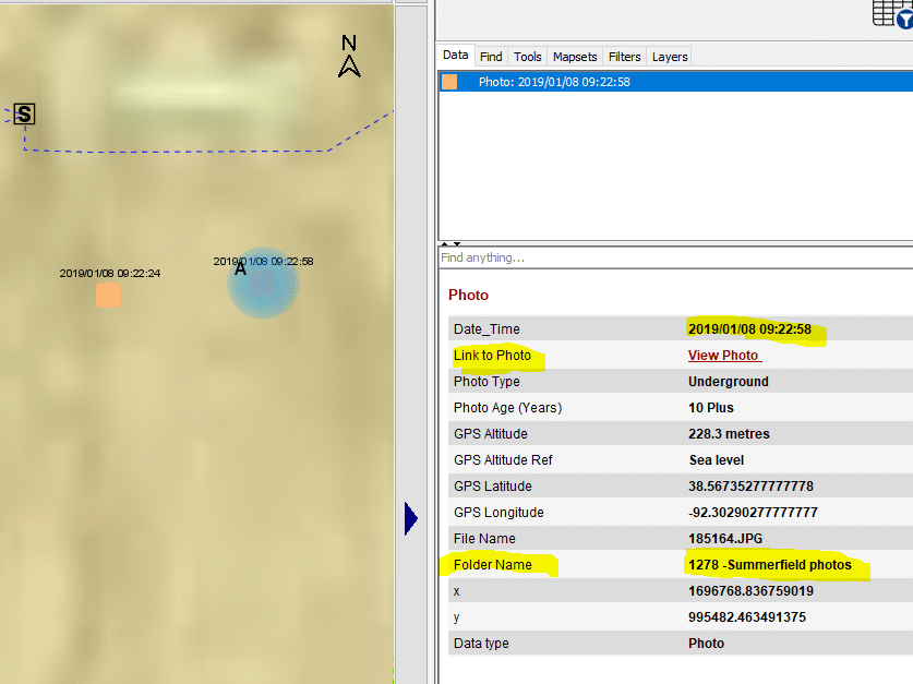
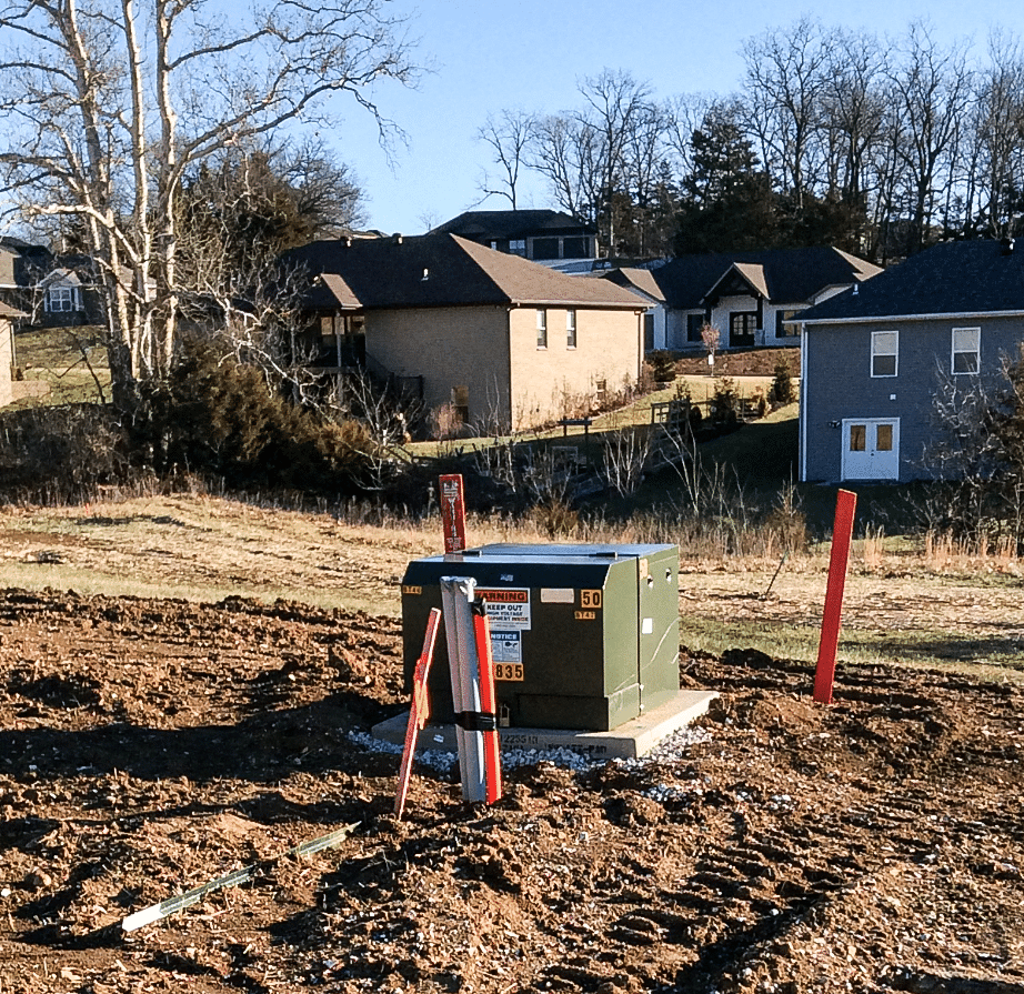
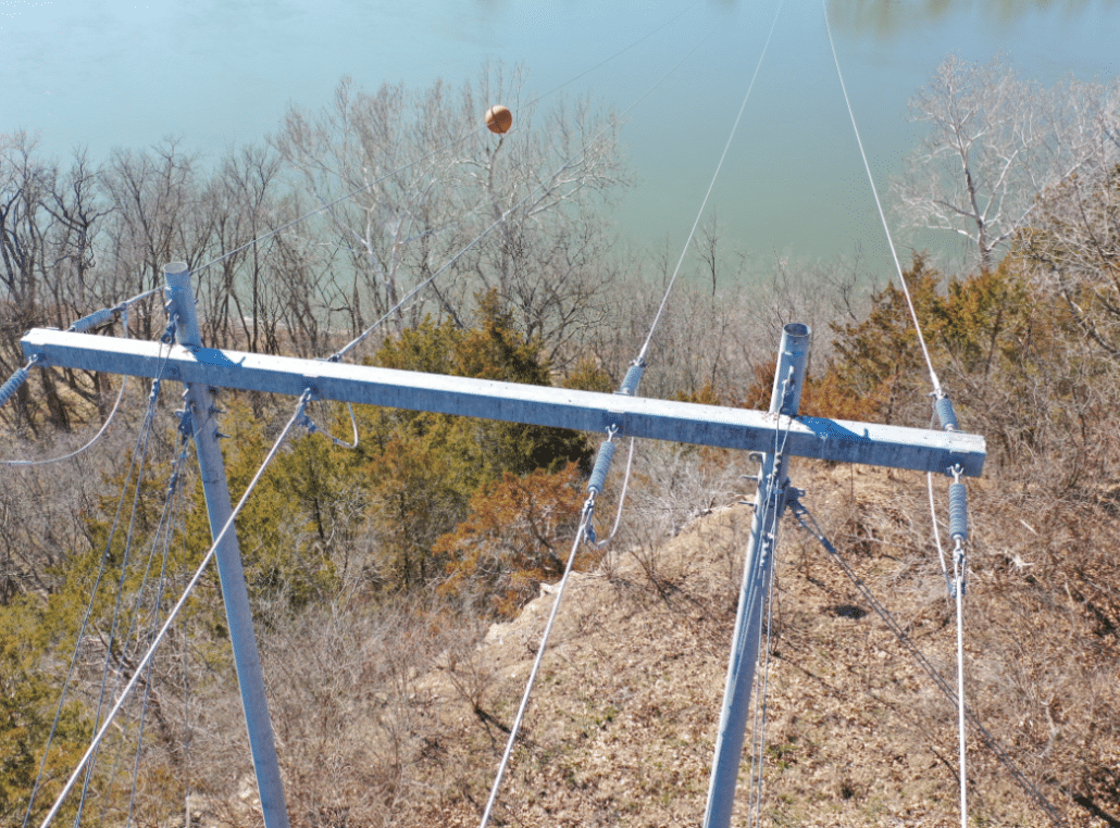
We had several companies approach us about doing drone inspections. The drones we already own are underutilized. And the cost for a company to provide the drone inspections, analysis, and house the data was too much. I knew that my part of the situation would be to deal with housing the data and making it available for review. When I did my own research into free software that addresses drone photos, my google searches all came back with products that allowed the user to build 3D models from their photos. I wanted to utilize the product we already have, which my coworkers are used to using. That’s about the time that I put my ideas and needs forward to Partner.Not only do we have the drone photo sets that will grow into huge data sets, we already have photos from as built inspections, construction crews, underground inspections we perform in house, etc. Most of these photos that already exist are buried away somewhere where most people didn’t know how to get to them. From my past experience making maps for electric utilities and collecting information for communication companies, I knew that one of the hardest parts to photos was pairing them with records already existing on a map. I knew that I wanted the photos to stand on their own so that I could prevent mismatches and prevent the effort that goes into attempting to match a photo to a pole. When the photo is the object on the map, there’s no match to make.
In the future, anyone with a smart phone can add to this data. That means our own employees and our contractors can add to this set. We can avoid following up on the work of construction crews for as built inspections. We could have our tree trimmers submit photo data as they clear stretches of ROW. There’s just a whole slew of potential uses for photos.
Having the photos out to the end user is a very helpful tool for everyone’s use. I especially enjoy the simplicity.
Aaron Winter
Engineering Coordinator
Three Rivers Electric Cooperative
Displaying them on our Partner map allows easy access for all of our users. That means that while a photo taken by a drone was intended to find a hollow top, its available for me to document the joint use status of a pole. It’s available for a staking engineer to verify assemblies. It’s available for our Member Service Representatives to reference when answering a phone call from the public. It’s a historical record that documents the condition of our pole at a certain point in time.
A key component of making maps is simplicity. This is simple.
Contact Partner Software for your drone mapping needs.